Will real winter with snow hit Serbia by the end of January: One phenomenon will be very dominant

Unfortunately, many parts of Serbia have no snow in the middle of winter, but there is more than enough on the mountains, as well as in the south of the country. However, when it comes to snow, the weather forecast is not very good.
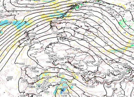
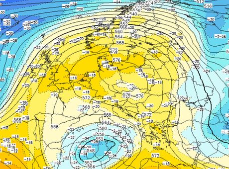
Serbia is under the influence of a very strong anticyclone, the center of which will move from Western Europe to the Alps and Central Europe. Air pressure will be very high. Due to this synoptic situation, the weather will be very stable and dry, and this phenomenon will be very dominant during the second half of January.

Still, a passing cloudiness will come from the north only tomorrow morning, so there will be some snowflakes, but without the formation or increase of the snow cover.
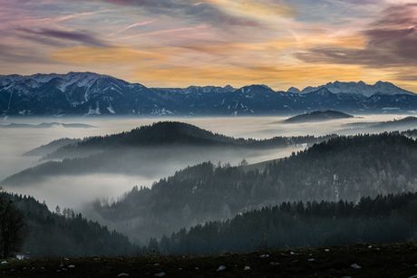
The weather will be very stable starting on Thursday. Temperature inversion is also expected, so it will be glum, foggy and cold in the lower regions, valleys and basins, with temperatures around 0 degress Celsius or a few degrees above.
In the hills and mountains and in the east of Serbia, the skies will be clear and warmer, with temperatures up to 10°C.
Nights and mornings will be quite cold. The minimum morning temperatures will range from -10 to -4°C, on the Pester Plateau and in the wider area of Sjenica down to -15 degrees, locally even lower.
In urban areas and industrial zones, and in areas with fog, the air will be very polluted, considering that due to the current synoptic situation without wind and with high pressure, all polluting particles will stay in the same area and in the lowest layer of the atmosphere.
Starting from the weekend, the weather in Serbia will be getting gradually warmer in the lower regions, and it will be significantly warmer next week, with temperatures around and above 10°C.
Unfortunately, even then, fog and low clouds will remain in certain low-lying areas, valleys and basins throughout the day, and it will be colder there.

According to the current forecasts at least until the very end of January, there is no sign of a significant cooling with precipitation and snow, i.e. - a real winter.
In addition to being above average warm, very dry weather is also expected, as the high air pressure prevents the penetration of humid air masses and precipitation from the Atlantic and Mediterranean into our space.
Those precipitation and strong cloud systems will move along the peripheral part of the anticyclone, to the north and south, i.e. across the Mediterranean and the far north of Europe.
When it comes to the mountains there will be no precipitation in those areas in the next ten days, but in all Serbian ski resorts will still have more than enough snow during that time.
(Telegraf.rs)
Video: Jaka snežna mećaca na Zlatiboru: Kolaps na ulasku u sam centar na kružnom toku
Telegraf.rs zadržava sva prava nad sadržajem. Za preuzimanje sadržaja pogledajte uputstva na stranici Uslovi korišćenja.


