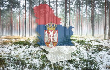
We reveal when first snow is expected in Serbia: Region has already "turned white"

The weekend behind us brought with it a very stark change in weather. After a summer-like period, some parts of the region saw the first snowfall, and now everyone is wondering if snow is expected in our country as well.
On the first day of the weekend, truly warm weather prevailed throughout Serbia, with temperatures up to 30 degrees Celsius. On the second day of the weekend, however, a cold front coming from the north brought a "big chill," rain and strong northwesterly wind. Before this cold front reached the southern and eastern parts of the country, temperatures there were as high as 29°C, but at the same time the northern province of Vojvodina reported an autumnal 12°C.
During that evening, the cold weather affected the whole of Serbia, so it became very chilly overnight, as the clouds gradually cleared.
The cooling was even more drastic in the region, so the first snow of this season covered higher regions of Slovenia and Croatia, and also of Bosnia and Herzegovina, during the morning also in the border areas along Kosovo and Metohija and Montenegro.
During the night on the higher mountains of Serbia, the temperature dropped below zero, but even though there were ideal conditions for snowfall this did not happen, because the precipitation had stopped.
Monday morning has been is dry, but still quite cold across Serbia. Temperatures ranged from 5 to 10°C, 8°C in Belgrade. Mt. Kopaonik reported -2°C, Mt. Zlatibor 3°C, and Sjenica 4°C.
Although there has been a significant cooling and a temperature drop of some 20 degrees compared to the weekend, snow is not expected in Serbia and there will not be any in the coming period.
According to current forecasts, it will not snow until the end of October neither on the mountainous nor in the lower regions of Serbia. After this cooling, unseasonably warm weather is expected again.
Considering that after this episode, there is no sign of any new severe colder weather to be expected, it is too early to specify when the first snow will fall in the lower regions.
Statistically speaking, if we look at a series of several decades, the average of the first occurrence of snow in Belgrade is November 22, which does not mean that this will happen this year as well.
During the previous winter, there was almost no snow in the lower regions, we welcomed the New Year and its first days with spring-like weather and temperatures up to 20°C, while April brought record amounts of snow for the season, up to 30 centimeters in the higher-lying parts of Belgrade.
Otherwise, today and tomorrow will be dry but relatively cold, with rain in the south on Tuesday.
Wednesday morning will be very cold, sometimes with frost, especially on the ground, mostly in Vojvodina.
It will become warmer during the day.
From Thursday, the weather is expected to be significantly warmer, but with frequent passing clouds and precipitation.
(Telegraf.rs)
Video: Macut: Trenutno su u toku projekti izgradnje čak 5 auto-puteva
Telegraf.rs zadržava sva prava nad sadržajem. Za preuzimanje sadržaja pogledajte uputstva na stranici Uslovi korišćenja.

